Interactive map of NAWDIC-KITcube measurement locations
NAWDIC-KITcube
The scientific focus of the KITcube component will be on downward momentum transport during high-wind events associated with dry intrusions. KITcube is a ground-based mobile observation platform for studying processes on the meso- to micro-scale (Kalthoff et al. 2013; https://kitcube.kit.edu). With its in-situ and remote sensing systems it allows detailed probing of an atmospheric volume with a particular focus on the PBL. During NAWDIC it will be deployed at the French Atlantic coast and equipped with one radiosonde autolauncher, five wind lidars, five water vapor lidars, one cloud radar, two X-band radars and surface energy balance stations. By aligning the instruments land inward in the typical wind direction observed during DI events, the complementary instruments will shed light on the role of surface inhomogeneities, atmospheric static stability and evaporation in precipitating areas on the downward momentum transport. Further, the assimilation of KITcube observations with the modelling system of the German Weather Service (DWD) is planned to assess the benefit of mesoscale observations for convective-scale weather forecasts. In coordination with ground-based observations performed by French partners in the NAWDIC-DICHOTOMI project, KITcube will be part of a dense observation network at the European Atlantic coastline.
Contact: Annika Oertel (KIT), Andreas Wieser (KIT)

Observational Setup & Instrumentation
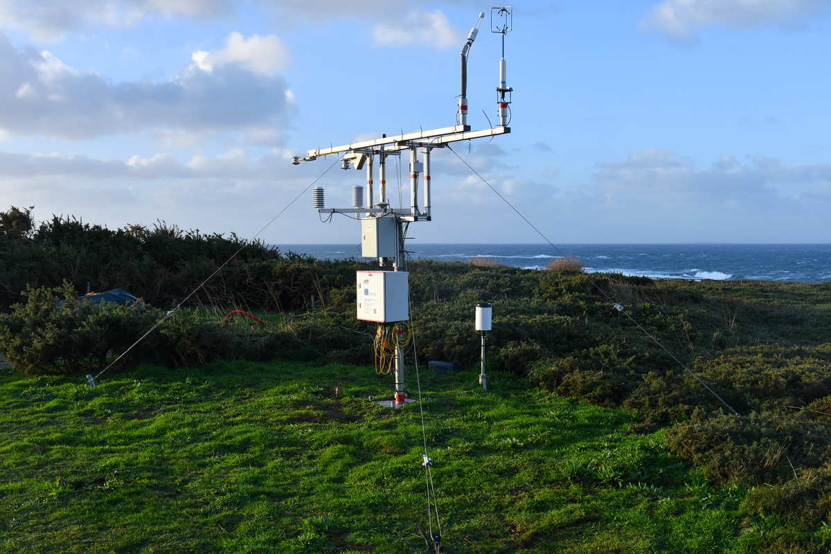
The measurement setup of NAWDIC-KITcube consists of the main site located near Porspoder directly at the Atlantic coast and four meso stations that are roughly oriented along a line reaching about 50 km inland. Two radar stations are situated north and south of this line (see map on the right).
Main Site (Porspoder)
- Automated Radiosonde Launcher Vaisala AS41
- Automated Weather Station (Energy Balance Station)
- Ceilometer Lufft CHM15K
- Cloud Camera System Mobotix S16
- Cloud Camera Reuniwatt Sky Insight
- Cloud Radar RPG FMCW 3594
- Differential Absorption Lidar DA10
- Doppler Lidar WLS200s
- Doppler Lidar Windcube V2 WLS7
- Doppler Lidar Windtracer HYB
- GNSS TX
- Microwave Radiometer RPG HATPRO G5
- Parsivel Disdrometer
- Raman Lidar Raymetrics
- Water Isotope Precipitation Sampler
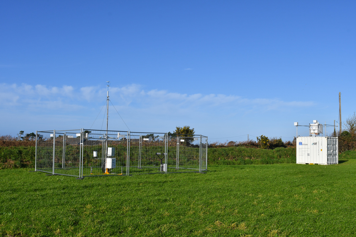
Meso Station 1 (Penfrat)
- Automated Weather Station (Meteorological Mast)
- Cloud Camera System Mobotix S16
- Differential Absorption Lidar DA10
- Doppler Lidar WLS200s
- GNSS TX
- Parsivel Disdrometer
Meso Station 2 (Milizac-Guipronvel)
- Automated Weather Station (Energy Balance Station)
- Cloud Camera System Mobotix S16
- Differential Absorption Lidar DA10
- Doppler Lidar WLS200s
- GNSS TX
- Parsivel Disdrometer
- Water Isotope Precipitation Sampler
Meso Station 3 (Guipavas)
- Automated Weather Station (Meteorological Mast)
- Cloud Camera System Mobotix S16
- Differential Absorption Lidar DA10
- Doppler Lidar WLS200s
- GNSS TX
- Parsivel Disdrometer
- Water Isotope Precipitation Sampler
Meso Station 4 (Irvillac)
- Automated Weather Station (Meteorological Mast)
- Cloud Camera System Mobotix S16
- Differential Absorption Lidar DA10
- Doppler Lidar WLS200s
- GNSS TX
- Parsivel Disdrometer
- Water Isotope Precipitation Sampler
Radar Site North (Saint-Pabu)
- Cloud Camera System Mobotix S14
- Parsivel Disdrometer
- X-Band Radar Gematronik Meteor 50DX
Radar Site South (Ploumoguer)
- Cloud Camera System Mobotix S15
- Parsivel Disdrometer
- X-Band Radar Gematronik Meteor 50DX