Animated flight tracks of HALO, NASA G3 and the EarthCARE satellite (Credit: Annabell Weber).

The last research flight of the campaign is over, and we look back at 18 flights distributed over six weeks, even more early mornings and long days, and a large amount of promising data that is only waiting to be analyzed.
In total, we dropped 127 KITsondes into cyclones over the North Atlantic Ocean. The simple vertical profile of temperature, humidity, and wind received from each sonde is the reward for a large amount of work that has been carried out in the days, weeks, and even months before the flight. Every sonde has a long history.
After assembling all the dropsonde containers by hand over several weeks last year at KIT, the sondes were transported to DLR in December and from there traveled all the way to Ireland in a large container to arrive just in time here in Shannon. Before each flight of the campaign, we spent some hours in the hangar and tested all the sondes once again before initializing them in the KITsonde station on HALO to make them ready for their one and only flight.
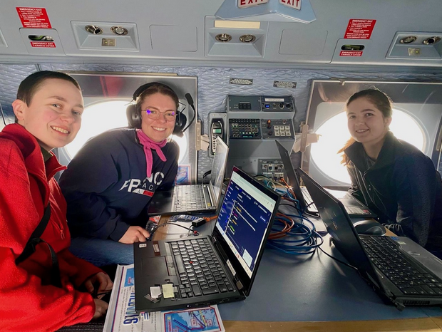
I was operating the KITsondes on board of HALO during two research flights in this campaign and before both flights I was super excited, nervous, and barely slept the night before. But once on the plane, it was always amazing. For the first couple of minutes after take-off, I could enjoy nice views of the Irish landscape and the ocean. Then I got to work in the back of the aircraft, where our KITsonde station was installed. Before each drop, I switched on the sondes, waited for the approval of the pilots to drop, and then released the dropsonde container through the airlock on the side of HALO. During the rest of the flight I was busy with reloading the KITsonde initialization station with new sondes, decoding the received data, dropping the next sondes from time to time, and sending the received dropsonde profiles to the ground so they could go into the data assimilation system in time.
Experiencing the full cycle of all the preparations beforehand, planning a flight, being on board of HALO to drop the sondes, and then seeing the recorded profiles in the end has been incredible. I am thankful that I could be a part of the NAWDIC campaign and I am looking forward to meeting all of you again in the following NAWDIC events :)
Magdalena Kracheletz (KIT)
The NAWDIC campaign presents a unique opportunity for early career scientists from different institutes and disciplines to work together. Through daily work side by side, we learn from one another and plant the seeds for future collaborations.
To make sure this newly formed community is a strong one, it was important to us to also get to know each other outside the high-pressure working environment. That is why, throughout the campaign, we enjoyed nights in the local pub and several house gatherings over dinner or drinks.
As we enter the final week, we may be saying goodbye for now, but this is only the beginning. We’re already excited to reunite at future NAWDIC workshops and continue working together to uncover new scientific insights from the data we worked so hard to collect.
Cheers to collaboration, community and what comes next.
Noy Klaider (Weizmann Institute of Science)


Last Friday’s IOP "Fermoy" was not only successful but also very special: for the first time within the NAWDIC campaign, all research aircraft linked to NAWDIC and based in Shannon, Ireland, met at one location at the same time to sample the 3D structure of the ongoing cold air outbreak over and around Ireland—HALO, ATR, and Cessna.
The tricky part of the mission was ensuring that all three aircraft were at the same location at the same time to fly a coordinated “leg” at different altitudes. This required precise timing and outstanding coordination among all participating institutes. Despite unforeseen challenges (waiting to change flight level, delayed takeoff, etc.), what had previously only been planned in theory worked out perfectly. Together, the three aircraft sampled enhanced latent heat fluxes west of Ireland at multiple flight levels (with two of the three aircraft flying the leg several times at different altitudes), using different instruments and measurement techniques.
Thanks to this exceptional team effort, we returned with excellent measurements of surface fluxes and cloud structures, recorded simultaneously by all three aircraft. Beyond the scientific success, another highlight was that the crews on board were able to see the other aircraft in flight—a truly unique moment!
Seraphine Hauser (ETH Zurich)
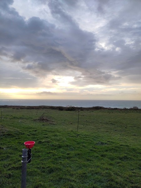
While couples are out on their evening stroll through Porspoder on Valentine’s Day, enjoying what will be the last sun rays of the following two days, our eyes are peeled on the rain radar of Météo France. Within the next hours, the warm front should arrive. In a coordinated effort, typical of the NAWDIC campaign, we will sample precipitation at high resolution during this frontal passage at multiple locations: Shannon, Britanny, Rennes and Dannemarie. These water samples will later be analysed for their isotopic composition, which is a natural tracer of the moisture’s transport history, to study moisture cycling within extratropical cyclones.
The warm front on 14 February has already been sampled in Shannon during the day, while we are waiting for our turn in Brittany. Unfortunately for us, the front does not adhere to business-like hours, and we are preparing ourselves for a night shift in the office container at the coastal main site of the KITcube, and in the car at MESO4 close to Irvillac further inland. At around 6 pm, the radar looks like the front will arrive earlier than expected; soon we will be able to sample the rain in high resolution. We hit the road to set up the sampler we use for high resolution sampling, consisting of a 3D-printed device that clamps onto whatever post we can find that is not shielded from the wind, and a bright red funnel collecting the rain into a 15 ml vial.
With 20 vials labelled and ready, we wait. And wait. And wait. It is not until just before 1 am that the first drops start to rhythmically patter on the roof of the car and the wind starts picking up, shifting from relatively still conditions to strong westerlies. Within one hour, the first four vials are brought in. Taking turns exchanging the vials and napping in the car, the hours pass quickly. As the sky turns from pitch black to a heavy grey and the lights turn on in the house next to the field, the rain starts to cease. Tired but in high spirits, we head back to our house, 32 vials of precious rainwater securely stored in the middle console, waiting to tell us their isotopic secrets.
Nina Fieldhouse, Jesse Connolly, Iris Thurnherr (ETH Zurich)
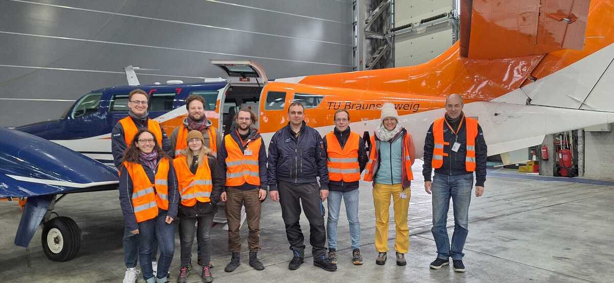
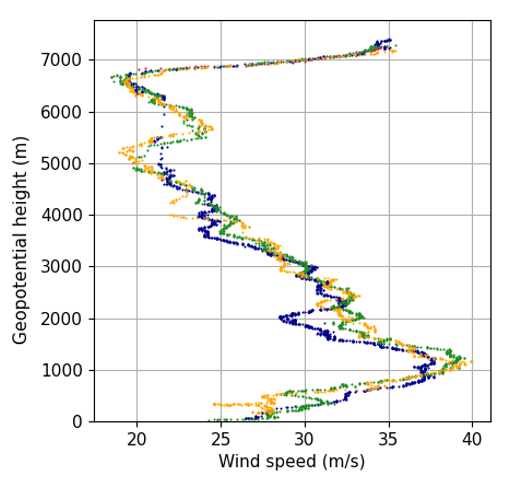
After three weeks of dancing around shallow boundary layer clouds, measuring 3D wind profiles below us, humidity and water isotope tracers of moist processes, the Cessna makes its final bow to NAWDIC and Shannon. With 18 flights of unique data from the nose boom (Institut für Flugführung, TU Braunschweig), the AIRflows Doppler Lidar (IMKTRO, Karlsruhe Institute of Technology) and the Picarro Cavity Ring-Down Laser Spectrometer (GIUB, University of Bern) in the pocket, the Cessna Team goes home with many very happy science memories. In our luggage we carry an exciting panoply of new measurements of the mesoscale substructures of midlatitude winter weather systems.
We flew towards warm fronts and within cold-air outbreaks, sampling the atmosphere above and below cloud layers, repeatedly crossing the land–sea boundary over the KITcube in Brittany, passing over the Valentia Observatory in Ireland (Met Éireann), and circling orographic cloud systems. Through the eyes of our instruments, we observed the processes driving high-impact weather, meticulously fishing out observations that reveal the key mechanisms at play.
Beyond the data, we take with us an incredible amount of learning along the way. What could be more instructive than the continuous rumble with the latest weather forecasts from different global and regional models to design the best possible flight plans, constantly adjusting to the latest estimate of what the atmosphere would do next? None of this would have been possible without our trio of curious and passionate pilots, as well as a highly motivated crew of operators and scientists.
With many grateful and deep thanks to the organisers of NAWDIC, the French-German DICHOTOMI project, the teams of HALO (German Aerospace Center (DLR)), ATR-42 (SAFIRE), KITcube, the airports of Morlaix (Merci à vous!) and Shannon (Thank you, Signature!).
The D-ILAB Team
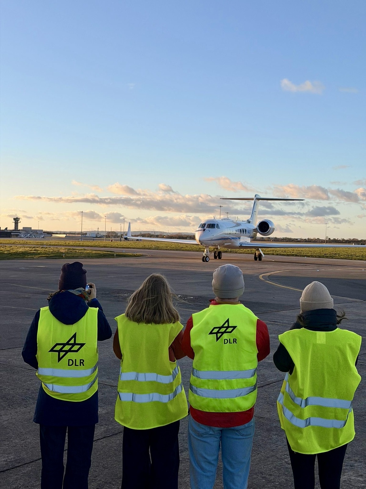
Recently, NURTURE and NAWDIC teamed up to conduct coordinated observations targeting a tropopause polar vortex (TPV) region that had previously been sampled by the NASA - National Aeronautics and Space Administration G3. Over several days, we developed an ambitious plan: to rendezvous at a specific time and location over the North Atlantic.
This effort was complicated by several factors. Flight plans had to be scheduled days in advance, winter weather conditions in Goose Bay (operation base of NURTURE) remained challenging, and TPVs are known for their limited predictability. To address these constraints, we identified a region that offered the highest operational flexibility and agreed to align our measurements with the EarthCARE satellite track, whose validation was of mutual interest to both teams. After monitoring the meteorological situation for several days and continuously adjusting the rendezvous points, we finalized a coordinated plan.
Receiving green lights from the NURTURE team, HALO took off from Shannon, Ireland at 13:20 UTC and set course for the western North Atlantic. The G3 departed from Goose Bay at 14:50 UTC. At around 17:10 UTC and almost to the minute, both aircraft arrived beneath the EarthCARE satellite track. As the aircraft approached the satellite track, excitement grew on board both platforms, especially once radio contact was established. Since both aircraft were flying precisely along the same ground track, the main challenge was matching speeds, ensuring that neither aircraft flew too fast nor too slow, a task more demanding than it may sound.
When the G3’s contrail became visible from HALO approximately the same time as the satellite overpass, the excitement among both teams was tremendous. The pilots carefully adjusted their velocities to align as closely as possible. Due to its slightly higher cruise speed, HALO briefly moved ahead before a planned course correction was executed. Thanks to precise coordination and clever turn planning, the G3 was subsequently repositioned slightly ahead, enabling another perfectly aligned joint leg.
This outstanding team effort resulted in 1 hour and 15 minutes of data collection while the aircraft remained almost perfectly collocated.
Andreas Schäfler (DLR)


Several NAWDIC flights have so far captured atmospheric rivers, dry intrusions, tropopause polar vortices, and winter storms. Let us take a look behind the scenes of flight planning and how forecasts of the targeted weather patterns are monitored.
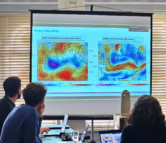
To capture the events of interest during flight, extensive preparatory work in forecasting is essential. We rely on various numerical weather prediction models, such as ECMWF-IFS, ICON, and GFS. During daily weather briefings, a dedicated forecast team involving many scientists closely monitors the latest forecasts to keep the NAWDIC team continuously updated on the targeted weather phenomena for upcoming flights. Not only the location of these features is important, but also the origin of the air masses to be sampled and their future pathways, for example toward the European continent. Trajectory analyses help illustrate the displacement of air masses by following the predominant wind fields backward and forward in time. These horizontal and vertical displacements can vary strongly with height, making a full three-dimensional representation necessary.
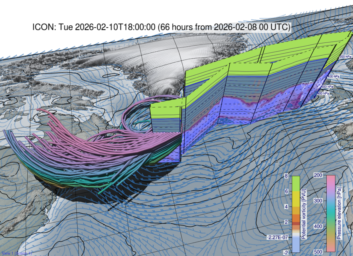
Different tools assist our team in visualising and analysing the weather forecasts for flight planning. For example, we utilize the interactive meteorological three-dimensional visualisation tool Met.3D (https://met3d.readthedocs.io/), which allows us to view forecasted atmospheric fields from all spatial perspectives, akin to observing an aquarium. We can track airmass trajectories, here represented as tubes colour-coded to display the variables of interest—such as the spatiotemporal evolution of a tropopause polar vortex (TPV) potentially to be sampled by a HALO flight on 10 February over the western North Atlantic.
Henning Dorff (University of Leipzig)
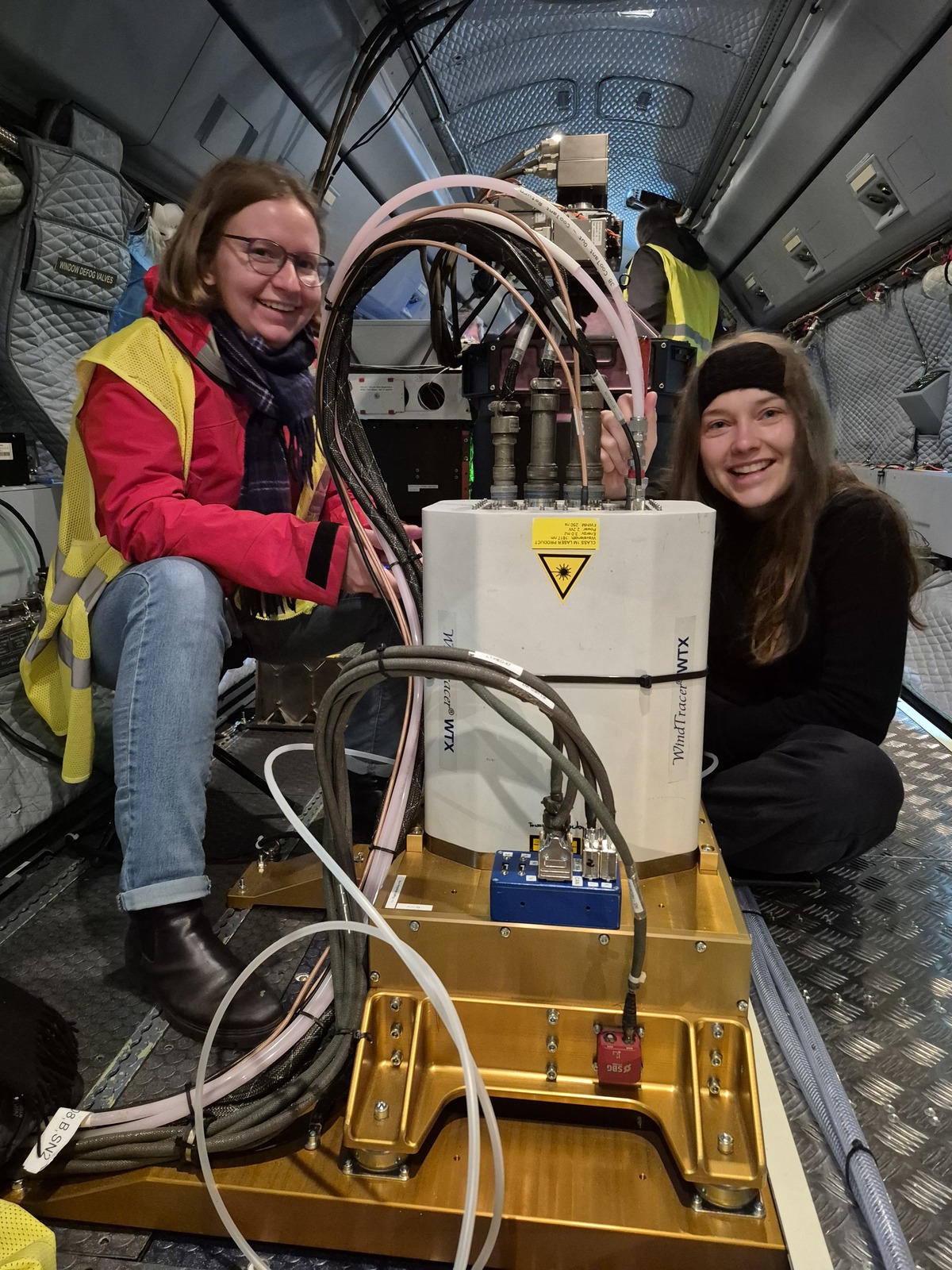
What do a laser and a bicycle tire have in common? It’s an automobile valve, of course!
The laser of our wind lidar HEDWIG indeed sports an automobile valve next to cables and hoses containing cooling liquid. The laser performs best when the relative humidity in its casing is low, which we have to ensure by flushing it with air – a task not much different from pumping a bicycle tire after having repaired it.
Therefore, in the early morning before the research flight RF09 Midleton, my colleague Katharina and I went to the hangar to flush the laser with air. The air is contained in liquid form in a gas cylinder, which is connected to the lasers’ automobile valve with a hose. A pressure valve on the cylinder regulates the outflow. We flushed the laser for one minute, then let out excess air by pressing the valve, as one would with a tire. Then we flushed again to replace the old, humid air in the casing with fresh, dry air, repeating the cycle over and over. With success: The relative humidity was 13% when the laser was started, a new record low!
The instruments are the backbone of a measurement campaign. That’s why, the work on the instruments in the hangar is of great importance. Every morning before a flight, scientists and instrument managers wake up early to prepare their instruments, ensuring they run smoothly for 8 hours straight. While the flushing with air is important for the HEDWIG laser, it is of course not the only work my colleagues and I have to do in the hangar. Since we are close to the city of Limerick, I have summarized my thoughts on the instrumental work in a poem of the same name:
For an airborne HALO campaign
Some necessities clearly remain
The work in the hangar
Is of elaborate manner
To ensure HEDWIG works on the plane
Elina Köster (DLR)
There once flew two lidars on HALO
For winds and wet air - quite the combo
We plan the best flight
Chase fluxes with might
Strong winds set out pulses aglow
Clouds? Nope. But aerosols YES!
Relative humidity makes our retrievals the best
We skim the oceans low
Grill fish with a glow
Go veggie to balance the mess.
-Unknown poet
This is a shortened English adaptation of a blog which originally appeared as MeteoSchweiz Wetterblog on 26 January 2026 (https://www.meteoschweiz.admin.ch/ueber-uns/meteoschweiz-blog/de/2026/01/auf-der-jagd-nach-winterstuermen-ueber-dem-atlantik.html).
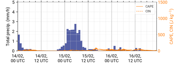
Last Thursday, winter storm "Ingrid" developed from a weak disturbance along a cold front into a powerful low-pressure system within just 24 hours. With a core pressure of around 960 hPa, it reached Brittany on Friday morning. A NAWDIC mission first investigated the absorption of moisture from the ocean into the atmosphere near the Azores. On its return flight to Ireland, HALO then crossed the core of the low. Planning such measurement flights is very challenging due to the dense air traffic over the North Atlantic and the uncertainties in forecasting. Nevertheless, measurements were successfully carried out both in the core of the low and above the developing strong wind field.
Winter storm Ingrid marked the beginning of a weather situation in which low-pressure systems are once again reaching Switzerland. Last week, Switzerland was still on the edge of a blocking high centered over Scandinavia and Northern Europe. The low-pressure systems moved further south and mainly affected the Iberian Peninsula and the Mediterranean region. However, the high is now moving towards Greenland, clearing the way for low-pressure systems.
Nevertheless, the low-pressure systems continue to track relatively far south because the high over Greenland and the polar region is blocking the typical path to Northern Europe. As a result, there will again be particularly high precipitation in the Mediterranean region this week. Conversely, one of the climatologically wettest regions in Europe – the west coast of Norway – remains surprisingly dry.
The ECMWF's subseasonal forecast also indicates that blocking highs over the Greenland region could continue to influence the large-scale weather situation in Europe in the coming weeks. This means that NAWDIC will continue to target low-pressure systems that tend to move along southern tracks.
On Thursday was my first flight on HALO, and it still feels a bit unreal. I first heard about HALO in a lecture during my meteorology studies. Back then, these measurement campaigns sounded exciting, but not something I expected to take part in myself.
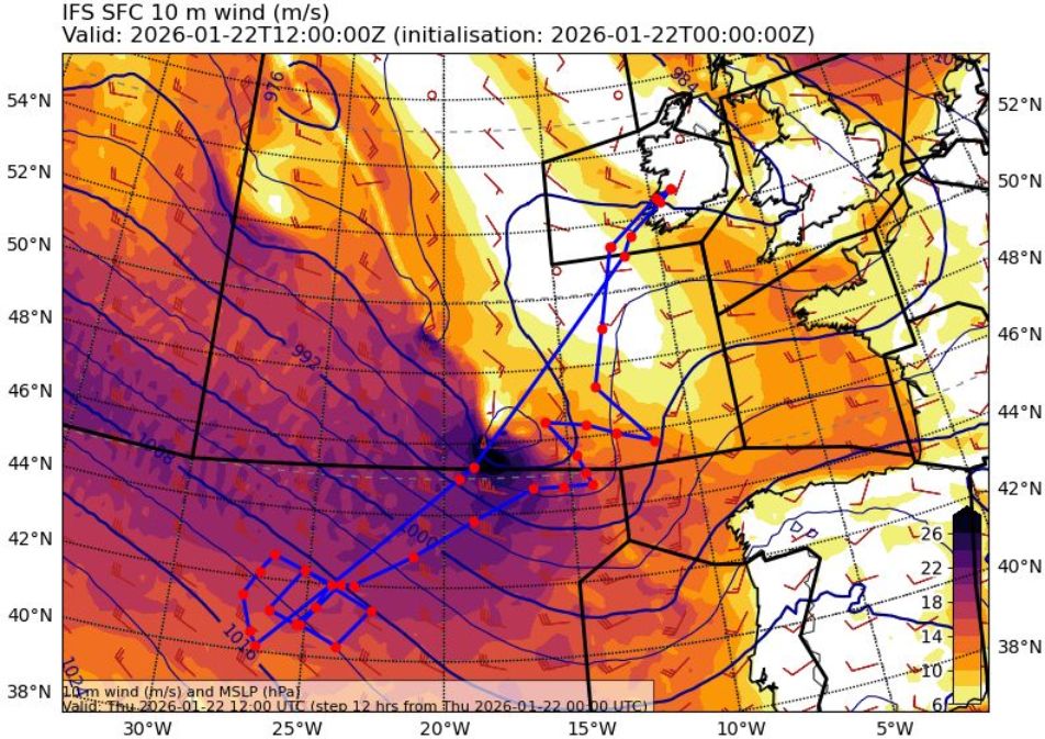
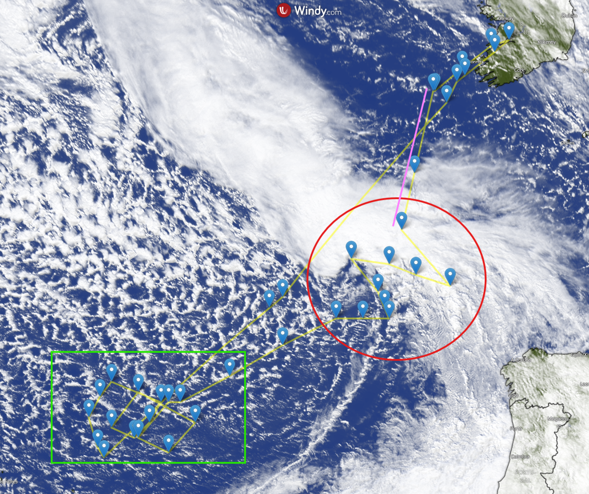
Part of what made it unreal was how spontaneous it was: I was told that I would be flying only the afternoon before the flight day. So, I learned how to use the dropsondes, and early the next morning we headed to the airport. On board HALO, we prepared the dropsondes, and shortly after, we took off from Shannon towards the Azores. During the flight, I was responsible for releasing the dropsondes. The sondes measure vertical profiles of temperature, humidity, and wind.
Not only was this flight exciting because it was my first one, but also from a scientific perspective: We first headed towards the Azores to measure increased latent heat fluxes within the cold sector of a low-pressure system (green box). The fluxes were measured with wind and water vapor lidar. After flying a formation whose shape looked a bit like an eight to measure the fluxes, we turned north towards a rapidly intensifying low-pressure system moving eastward (red circle). Hitting its location so precisely was a highlight of the flight, especially given the large forecast uncertainty during planning the flight. Thanks to the flight planning team and great ground support, we were able to catch it.
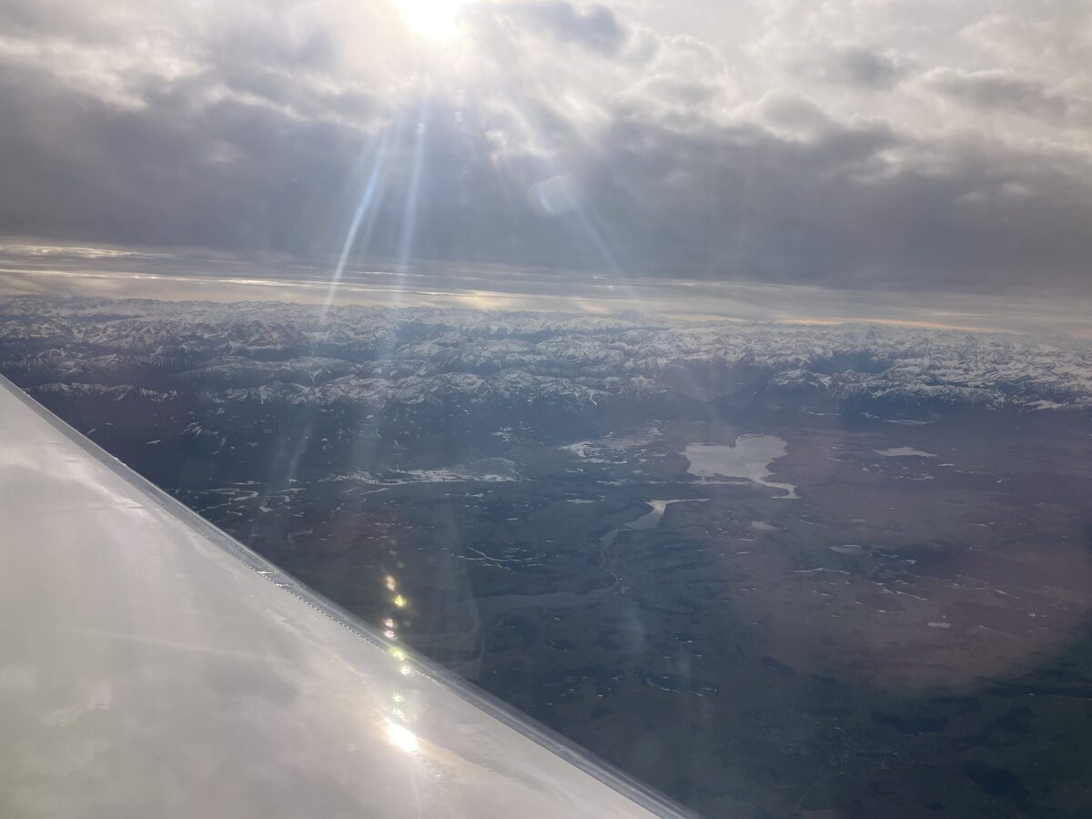
Flying through a cyclone is not only scientifically fascinating but also something you definitely remember on board, thanks to the turbulence :) Even though it was very shaky, we were able to drop the sondes as planned, and the first quick looks already looked great. On our way back to Shannon, we were also able to underfly EarthCARE (pink line), which intersected the same low-pressure system. All in all, a successful first flight with HALO.
Annabell Weber (DLR)
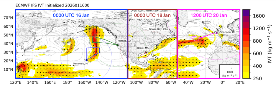
The North Atlantic Waveguide, Dry Intrusion, and Downstream Impact Campaign (NAWDIC) is an international field campaign designed to improve the understanding and prediction of high-impact weather over Europe by observing upstream dynamical and thermodynamical processes across the North Atlantic. Within this framework, NAWDIC-Atmospheric River (NAWDIC-AR), a subset project of NAWDIC-HALO missions, led by Alexandre Ramos (Karlsruhe Institute of Technology), focuses specifically on improving predictability of significant impacts over Europe by sampling AR moisture source regions as they propagate across the North Atlantic toward Europe.
NAWDIC-AR is occurring alongside several coordinated field campaigns simultaneously underway across the Northern Hemisphere, all aimed at advancing the prediction of high-impact weather systems. Among these is Atmospheric River Reconnaissance (AR Recon), a long-running, annual field program led by co-PIs Marty Ralph (Center for Western Weather and Water Extremes/UC San Diego/Scripps Institution of Oceanography) and Vijay Tallapragada (NOAA/NCEP/EMC), focused on targeted observations of ARs that pose significant hazards to the United States. Current operations involve multiple Air Force C-130 and NOAA G-IV aircraft based in California, Hawaii, and the southeastern U.S. to sample ARs upstream of the U.S. West Coast and Atlantic ARs threatening the U.S. East Coast to observe moisture transport, winds, and thermodynamic structure.
In addition, a NASA-funded North American Upstream Feature-Resolving and Tropopause Uncertainty Reconnaissance Experiment (NURTURE), led by PI Steven Cavallo (University of Oklahoma), will begin operations on 26 January from Goose Bay, Canada. NURTURE aims to quantify how perturbations poleward of the jet stream—particularly in the upper troposphere and lower stratosphere—modulate jet variability and the predictability of high-impact weather.
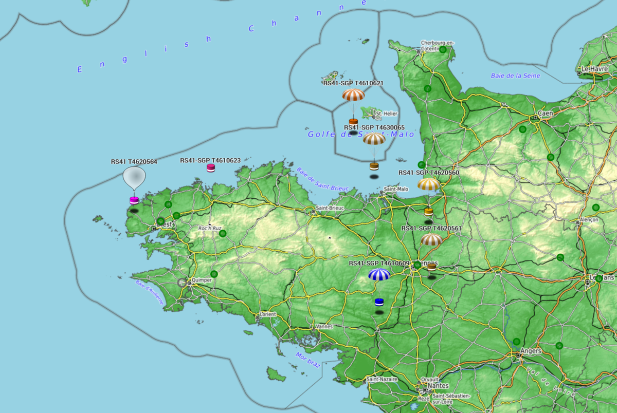
Building on these basin-scale and cross-basin efforts, the concept of a Global Atmospheric River Reconnaissance Program (GAARP) was developed by PIs Marty Ralph (CW3E/UCSD/SIO) and Vijay Tallapragada (NOAA/NCEP/EMC). GAARP envisions coordinated global AR observations across multiple ocean basins, leveraging aircraft, radiosondes, and international partnerships to follow ARs throughout their life cycle. Viewed in a Lagrangian framework, as illustrated by the time-evolving IVT structures in the accompanying map, these efforts aim to advance week 2 forecasts by sampling all ARs in the Northern Hemisphere, representing a major step toward a globally coordinated AR observing strategy.
Peyton Capute (CW3E)
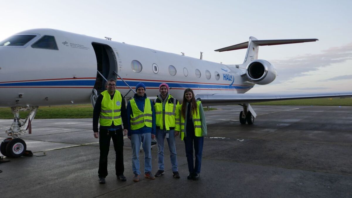
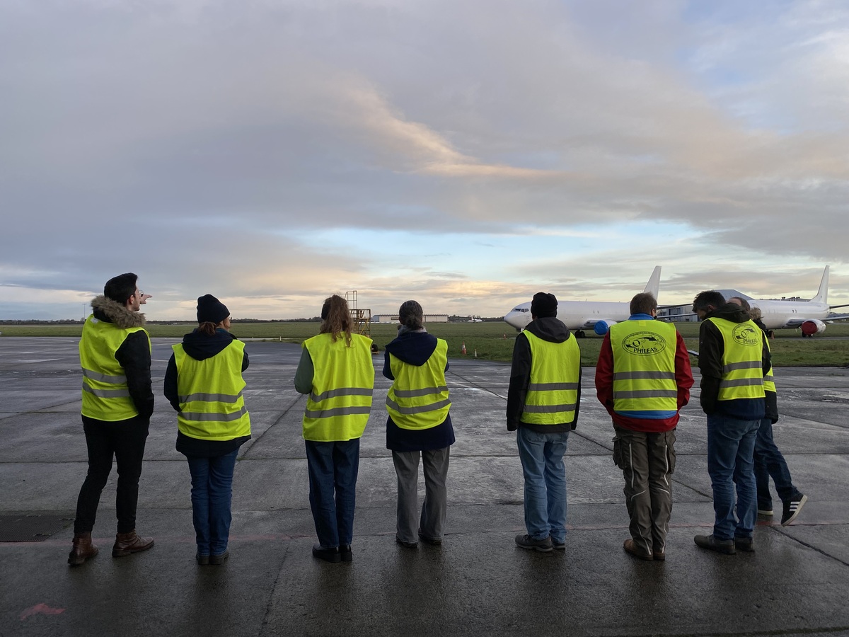
I often talk to people who assume that campaign life is much like being on vacation—especially when destinations include the Caribbean or New Zealand. And indeed, many vacations start by waking up at 05:30 to head to the airport and catch a flight. Today, the flight we had to catch was HALO’s first research mission from Shannon. However, instead of queueing at security, grabbing a coffee afterwards, and waiting at the gate, a research flight requires thorough preparation.
Depending on the instrument, this can mean arriving at the hangar up to four hours before take-off to heat up, calibrate, flush, or clean systems. Once HALO is towed out of the hangar and the flight crew—including instrument operators, pilots, and technicians—arrives, the aircraft quickly becomes crowded: the familiar hustle and bustle of a flight day. Instrument-responsibilities are handed over from the preparation to the operation teams, final reports are exchanged, and everyone not scheduled to fly leaves the aircraft. And just like that, HALO is off on a seven-hour mission.
For the scientists remaining on the ground, the day continues with weather briefings, flight planning, and data processing, while staying in constant contact with their colleagues on board to provide support if needed.
Today’s scientific targets included measuring enhanced surface latent heat fluxes in the cold sector of a cyclone and capturing another transition from tropospheric to stratospheric air masses. The former is achieved by combining water vapour measurements from a differential absorption lidar with vertical air motion derived from a wind lidar. The latter is best observed using in-situ measurements of ozone and nitrous oxide. These two trace gases are anti-correlated: when crossing from the troposphere into the stratosphere, one ideally observes an increase in ozone accompanied by a simultaneous decrease in nitrous oxide. Neither of these processes is visible to the naked eye. However, one of the operators provided this photo: a halo observed from HALO—one could even say (HALO)².
Anja Stallmach (LMU Munich)


While my colleagues from the specMACS team had to travel to Ireland commercially yesterday, I opted for the business jet—complete with all the perks of private aviation: a direct connection from Oberpfaffenhofen to Shannon, complementary coffee and only 5 other passengers sharing the aircraft with me.
Even though HALO is a Gulfstream 550 jet, you won’t find carpeted floors or champagne flutes being passed around. The luxury we experience on HALO is of a different kind. HALO brings atmospheric scientists together, enables us to explore synergies between different instruments and carries us close to the phenomena we otherwise only analyze on computer screens in our offices.
Today therefore marks the start to the HALO measurement phase of the NAWDIC campaign. Although we had a direct connection to Shannon, HALO took a small detour via Switzerland and France, before doing a final loop over the Atlantic to sample a pronounced tropopause fold and boundary-layer cumulus clouds in the cold sector of a preceding cyclone. Ireland greeted us with sunshine and the hangar was crowded with our large welcome comittee.
HALO has touched-down in Ireland—here is to a successful, storm-laden and joyful campaign!
Anja Stallmach (LMU Munich)
Loren:
I arrived at the 2 December in Brittany. Arriving at a measurement campaign for the first few weeks of operation, means that there are still some additional set ups to do. So, I spend my first week with driving and carrying around the house and the laser of a DIAL in addition to the first station maintenances in quite strong winds and rain. However, it was a fun experience and caused amazing cloud formations.
Viktoria:
When I arrived one week later, it was in the midst of an IOP and I was first greeted by heavy precipitation when stepping out of the train station. An atmospheric river arrived at the French coast line the night before. This motivated an IOP from 08 to 09 December with 3-hourly radiosondes launches at the main station in Porspoder to get a detailed overview of the atmospheric conditions during this event and the associated heavy precipitation and strong winds.
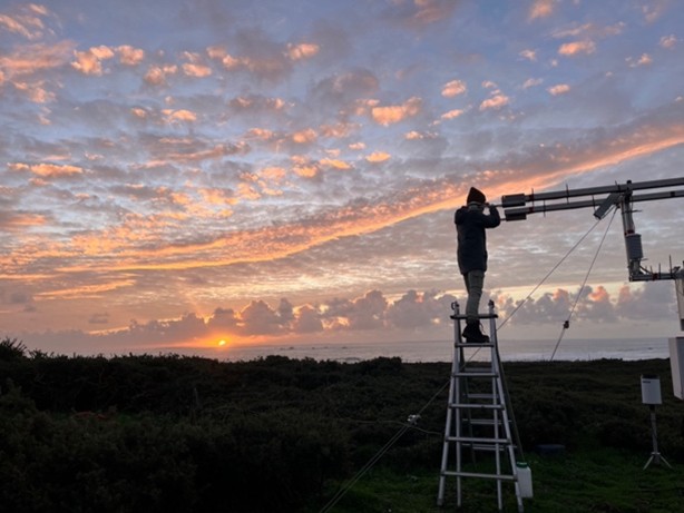
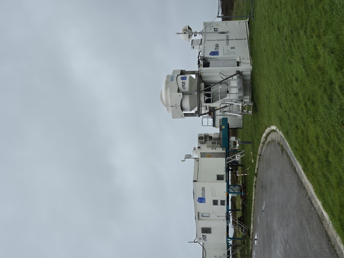
After the storm had subsided, we were accompanied by rather calm and sunny conditions for the next few days. With temperatures around 10°C, it often felt more like early autumn here, although it was in the middle of December. While these were not the weather conditions we are interested in, it was a great opportunity to do some maintenance at the main station and the four meso stations. Maintenance includes checking the alignment of measuring masts, carefully cleaning lenses and measuring devices in case of contamination, replacing the desiccant in the Doppler wind lidars, and much more. Since we launched multiple radiosondes during the IOP, we also decided to fill up the auto launcher to be prepared for the next events.
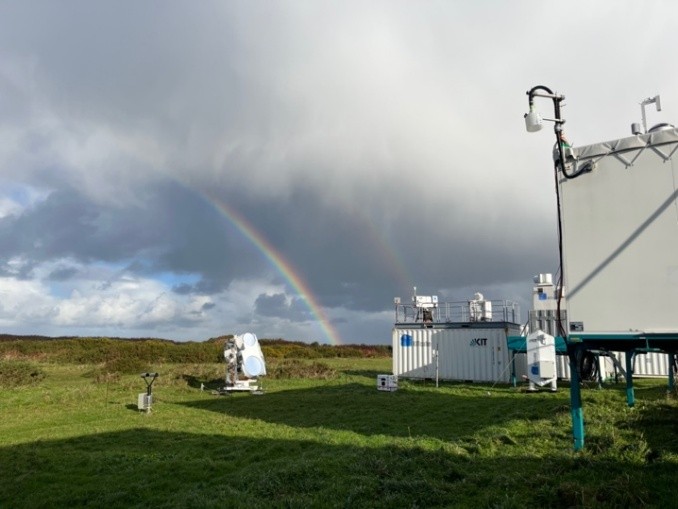
Especially at the main site which is located close to the coast there were a lot of striking weather phenomena to observe. Rainbows occurred on several days and on one day in the evening while tending to the energy balance station, we managed to capture the formation of marine boundary cumulus in the sunset. We’re looking forward to the detailed measurements from the campaign and new insights of the interaction of the ocean and coastline.
Loren Schäffler and Viktoria Dürlich (KIT)
When I prepared for my first field trip a few days after new year’s, I could not have known how intense and exciting my stay in Brittany would turn out!
In the second week of January, winter storm Elli (named Goretti by Météo-France and Elli in Germany) developed over the North Atlantic as a frontal wave and intensified under strong upper-level forcing. The models predicted strong wind gusts in the warm sector, accompanied by a pronounced cloud head (bent-back front) with a likely formation of a sting jet that would pass directly over the NAWDIC KITcube site in Brittany in western France.
Based on this prediction, the NAWDIC scientific lead issued an intensive observation period (IOP) with a high frequency of radiosonde launches during Elli’s passage. For me – having neither been involved in field measurements nor any radiosonde ballon launches before – there could not be a more exciting case for my first campaign experience! And not only that: Elli developed to a textbook-like example of a midlatitude cyclone! No theoretical lecture could have thought me the dynamics better than being on site, frequently checking weather maps and KITcube’s remote sensing data, launching ballons and tracking their flight paths!
Over the course of the 8th January, we launched 11 radiosondes. The 18:30 UTC ballon experienced such high windspeeds that it got pushed halfway out of KITcube’s autolauncher vessel. With adrenalin up high, we launched another sonde right after. This time, due to turbulence, it hit the vessel multiple times before it finally departed upwards. Watching the strength of the storm throughout the “eyes” of the autolauncher cameras was a unique and unforgettable experience. Eventually, Elli’s core passed north of Brittany with windspeeds of up to 154 km/h measured on the Channel Islands in the night of 8th January.
Two days later, Elli’s leading warm front collided with cold polar air over parts of Western Europe, creating wide bands of snow across the northern and eastern parts of Germany. Meanwhile, we monitored the impacts Elli left in Brittany. Multiple power outages affected the KITcube sites any some of the devices had to be rebooted manually. Now, one week after our arrival in Brittany and four days after the storm, Brittany shows again its sunny side. But stay tuned, the next intensive observation period is just about to come!
Julia Thomas (KIT)
When I came to KIT more than two years ago, the year 2026 seemed to be very far away. Preparing a major aircraft campaign like NAWDIC requires several years for good reasons. You need to think about how to organize a typical campaign day, to share the weather forecast and flight planning duties among more than 50 participants, and to consider instrument limitations and ATC restrictions, not mentioning the scientific coordination between all sub- and partner projects, transport logistics, travel planning, finances, and outreach activities. The complexity of all this can be overwhelming and fascinating at the same time, but also very abstract in the end.
Luckily, time flies and as soon as 2026 has finally arrived, suddenly everything becomes very real. Also the weather seems to remind us that it's time now. While storm Goretti rushes through the English Channel and hits Northern France with winds of more than 200 km/h (not far away from the KITcube location), we travel to Ireland to start into our six-week NAWDIC adventure. Since HALO will only arrive next week, we have enough time to move into our flat, to unpack the instrument equipment from the shipping containers and to set up the meeting rooms. Everything is ready now. We cannot wait for more storms to come and finally for NAWDIC to begin!
Bastian Kirsch (KIT)


Entering the hangar with the HALO research aircraft always feels special, but even more so today: it's the first time I've been allowed to fly on a research flight!
The beginning is already known: We work through the switch-on checklist for the instrument together as usual, and I also know how to hangar the aircraft from previous campaigns. But when the door of the converted Gulfstream G550 closes, it's different: now I'm sitting inside, not watching the plane take off as usual. A quick calibration is carried out, then we taxi onto the runway and off we go towards the North Sea!
Three of the four other scientists are also flying on this test flight for the first time today. Of course, nobody wants to make a mistake here, so there is a concentrated silence over the roaring cabin interior, where we sit between buzzing instruments and eagerly follow the measurement data on the laptops in front of us.
We can communicate with the others via headsets and write to the ground via a data stream. The lectures on air pollution and measurement methods are also watching from time to time. Luckily, everything is going well while the situation starts to get exciting:
The forecast already said that a tropopause fold could be observed: A region in which sinking air from the otherwise higher stratosphere penetrates to lower altitudes. And indeed, shortly after the end of the ascent, the aircraft begins to jerk and there is slight turbulence, indicating that something is happening in the atmosphere. Almost simultaneously, the measured values begin to change: N2O decreases while ozone increases, an indication of more stratospheric air masses and thus a possible tropopause fold.
The feeling is difficult to describe, it feels almost magical: Nothing can be perceived from the outside, the air is transparent and a tropopause fold is not visible to the naked eye. But we in the plane feel how it jerks, notice how our instrument can perceive changes in the air composition of 0.0000001% and can thus make this invisible phenomenon visible. Theory becomes practice, and I will remember this day forever.
Jonas Blumenroth (IPA, JGU Mainz)
Gray clouds hang low over the airfield in Oberpfaffenhofen. A rumble is heard as the aircraft's engines start up. Then HALO emerges from behind a building, zips across the runway and takes off. After a few seconds, it disappears into the low-hanging clouds and our observation post on the roof platform falls silent.
Inside the aircraft, however, the technology is now being eagerly tested. After six weeks of installation and testing, all the scientific instruments have been installed in the aircraft and HALO is ready to take off. Today's EMI flight is the very first of the NAWDIC campaign. EMI stands for electromagnetic interference. Following a ground test two weeks earlier, the aim is to ensure that the aircraft electronics and the electronics of the scientific measuring instruments do not interfere with each other and that the aircraft still flies safely despite all the equipment. From Oberpfaffenhofen, HALO will fly to the TRA (Temporary Reserved Airspace) Allgäu and back.
Stephan is there for our team and has some time during the successful flight to take a picture of Forggensee with Füssen and Neuschwanstein Castle in front of the Allgäu Alps.
After three hours, there is another rumble of thunder in the clouds and shortly afterwards HALO taxis back onto the apron in front of the hangar. We quickly save the data and switch off our UMAQS device completely. Now everything is ready for the scientific test flight next week.
Isabel Kurth (IPA, JGU Mainz)